Thinking about buying a lot in Bay County? Zoning is the small line on a map that decides what you can build, how big it can be, and how many units you can fit. If you skip this step, you risk buying land that cannot deliver your plan. In this guide, you’ll learn how to find the official facts, read Bay County’s zoning rules, spot common red flags, and map the permits that affect timelines and budgets. Let’s dive in.
Start with official sources
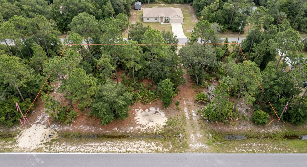
Begin with the parcel. Pull the legal basics and map from the Bay County Property Appraiser. Use the parcel ID on everything that follows. You can search by owner, address, or map and copy the Parcel ID from the record. Start here: Bay County Property Appraiser parcel search.
Next, confirm the mapped zoning and the Future Land Use designation. Use the county’s interactive viewer to see both layers and capture screenshots for your file. Open the Bay County Future Land Use and Zoning map.
Then get it in writing. The county encourages you to request an official zoning verification using the Parcel ID. Staff can confirm permitted uses, setbacks, overlays, and whether any special rules apply. See the county’s guidance on how to request zoning verification.
If you want full context, the county’s planning pages host the Comprehensive Plan and the Land Development Regulations (LDRs). These are the rulebooks that control use, density, height, and process. You can browse the Comprehensive Planning overview for links to core documents.
FLUM vs. zoning explained
Bay County uses two linked tools. The Future Land Use Map (FLUM) sets broad land use categories like Residential, Commercial, Industrial, Agriculture, and Conservation. The LDRs then translate those categories into specific zoning districts with concrete standards.
For residential land, you will commonly see districts like R-1 (single family), R-2 (single family and duplex), R-3 (small multi), R-4 (manufactured/mobile home), and R-5 or R-5A (multifamily). Commercial districts range from neighborhood-scale to mixed use. Industrial, agriculture, and conservation districts round out the set.
Your project lives or dies on those district rules. They decide if your use is allowed by right, whether you need a conditional use, and which setbacks, heights, and lot standards apply.
Key numbers that shape buildability
Bay County publishes a “bulk regulations” table that summarizes the critical numbers: density, setbacks, heights, and impervious surface ratios. Before you budget a design, check this table for your exact zoning district and service area. Review the county’s Zoning Bulk Regulations summary.
Here are common figures buyers run into. Always confirm the specifics for your parcel:
- In R-1 within an Urban Service Area, the urban maximum density is listed as 8 dwelling units per acre. Typical setbacks are about 20 feet front, 5 feet side, and 10 feet rear. The impervious surface ratio is about 60 percent. Urban maximum building height is about 45 feet.
- In R-2 and R-3, urban densities are shown at up to 15 dwelling units per acre. In R-5, multifamily density in the Urban Service Area can reach about 25 dwelling units per acre.
- Service areas matter. The same zoning district may allow lower densities in Suburban or Rural areas, sometimes dropping to around 5 units per acre or even 1 unit per acre.
- Utilities matter too. Many density allowances assume central water and sewer. Without them, you may be limited to lower densities or face the cost and timing of extensions. The bulk table notes this dependency.
- Coastal limits apply. In the Coastal Planning Area and Beaches Special Treatment Zone, many residential densities are capped at 15 units per acre. The summary table calls out these caps.
These numbers control lot yield, house footprints, driveway areas, and outbuilding plans. They also shape stormwater and access design, so they cascade into costs.
Overlays and site constraints to check
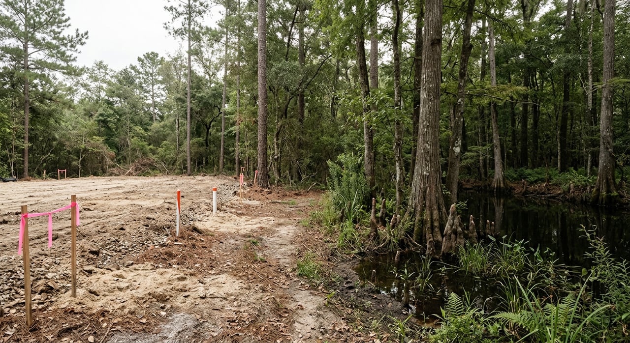
Even the right zoning can be constrained by site conditions and overlays. Work through this checklist before you commit:
- Flood hazard. Bay County participates in the National Flood Insurance Program. If a parcel lies in a mapped flood zone, you may need to elevate pads, add flood-proofing, and obtain elevation certificates. Check county flood resources on Flood Zones and CRS Information.
- Beaches Special Treatment Zone. Along the coast, the BSTZ adds limits that often cap residential density at 15 units per acre and layer on site and structure rules. Confirm any BSTZ flags using the GIS viewer and the bulk regulations table.
- Wetlands and surface waters. Wetland impacts typically require an Environmental Resource Permit and may involve the State 404 program or the U.S. Army Corps. Review recent activity and understand what a delineation and mitigation could mean for your acreage. See the DEP’s regional notices for context at Environmental Resource Permit application notices.
- Septic vs. sewer and water source protection. The county’s Potable Water Sub-Element documents Deer Point Reservoir as the primary source and includes protections like a prohibition on new septic tanks within 200 feet of any community water well. Confirm utility availability and likely fees early, and verify septic feasibility if sewer is not present. Read the Potable Water Sub-Element and Work Plan.
- Airport, military, and sector-plan overlays. Height, noise, or special procedure rules can apply near airports or in large sector-plan areas such as West Bay. Ask Planning staff to flag any such overlays when you request zoning verification.
- Environmental standards. Tree protection, habitat conservation areas, lighting near turtle habitat, and Outstanding Florida Waters policies can affect clearing, fill, and building footprints. Confirm any site-specific constraints during due diligence.
Permits and the path to “go”
Most single-family builds move through Building Safety, while larger projects need formal development review. Plan your path with these steps in mind:
Confirm FLUM and zoning. Use the GIS viewer and then ask staff to confirm in writing. For an overview of county planning materials, start with Comprehensive Planning.
Check whether your use is allowed by right. If not, you may need a conditional use, variance, rezoning, or a Future Land Use Map amendment. Larger use changes involve hearings and formal submittals.
Determine if you need a Development Order. Commercial, multifamily, and subdivisions usually require a Development Order and formal review. The county recommends a pre-application meeting to identify thresholds, timelines, and needed studies. See the Development Review process.
Coordinate parallel permits. If you affect wetlands or surface waters, an ERP and possibly 404 authorization will be required. If your project affects water or sewer capacity, concurrency or utility availability checks will be part of review.
Understand timing. Small-scale plan changes are processed year-round. Large-scale comprehensive plan amendments over 50 acres generally take about three to five months to work through the formal process of notices, hearings, and any required state reviews. You can browse timing context on the Comprehensive Planning page.
Pull building permits. Use the county portal for submittals and status. For basics on triggers and search tools, visit Permits and Building Safety.
Buyer due diligence checklist
Use this simple workflow to reduce risk and speed decisions:
Get the Parcel ID from the Property Appraiser and download the parcel map and legal description. Use the Bay County Property Appraiser search.
Open the county GIS, turn on Future Land Use and Zoning layers, and save a map of the parcel with the legend. Use the FLU/Zoning map viewer.
Request an official zoning verification. Ask Planning staff to confirm permitted uses, setbacks, overlays, and any sector-plan rules. Here is the county’s zoning verification FAQ.
Check flood status and, if applicable, ask for any existing elevation certificates from the seller. Start with Flood Zones and CRS Information.
Confirm water and sewer availability and likely connection or impact fees. If no sewer, verify septic feasibility with a local pro and review county and FDOH records. The Potable Water Sub-Element explains key protections and service-area context.
Screen for wetlands. If the site looks suspect, order a wetland delineation and check state notices for any related permits on or near your parcel. Browse DEP ERP notices.
Pull the numbers from the bulk table. Confirm density, setbacks, height, and impervious ratios for your zoning and service area. Use the Zoning Bulk Regulations.
If your plan needs a rezoning, conditional use, or Development Order, schedule a pre-application meeting and request a checklist and fee estimate. See Development Review.
Common pitfalls to avoid
- Counting all deeded acreage as buildable. Wetlands, buffers, and FEMA floodways can shrink your usable footprint.
- Assuming high density without central utilities. Many densities depend on central water and sewer. Without them, your project may downshift to rural or suburban limits.
- Relying on an MLS zoning label. Always verify with Planning staff using the Parcel ID and save the response in your file.
- Skipping coastal checks. In the Beaches Special Treatment Zone, density caps and design standards can change feasibility and yield.
How a land specialist helps
A land-focused agent saves time by front-loading feasibility. That means pulling parcel records, running the GIS zoning and FLUM layers, and requesting zoning verification on your behalf. It also means coordinating surveys, septic feasibility, and wetland delineations when the map raises a flag, and setting up pre-application meetings if you need a Development Order or an entitlement change. You get clear next steps, realistic timelines, and introductions to the right vendors to keep the deal moving.
Ready to run a parcel through this playbook before you make an offer? Schedule a Free Land & Zoning Consultation with Tina N Marsh to get a fast, practical read on buildability and next steps.
FAQs
What is the fastest way to verify zoning in Bay County?
- Use the county’s GIS to view the parcel’s FLUM and zoning, then request an official zoning verification from Planning & Zoning using the Parcel ID. See the county’s guidance on zoning verification.
How does lack of sewer affect allowed density?
- Many density limits assume central water and sewer. Without them, densities often drop to suburban or rural levels. Confirm your exact numbers in the Zoning Bulk Regulations.
What is the Beaches Special Treatment Zone and why does it matter?
- The BSTZ applies to coastal areas and often caps residential density at 15 units per acre while adding site and design standards. Check the GIS and confirm caps in the bulk regulations.
Do I need a Development Order for a single home?
- Most single-family homes go through Building Safety for permits, but site review may apply if your project affects drainage or other standards. For permit basics, visit Permits and Building Safety.
How long do large plan amendments take in Bay County?
- Large-scale comprehensive plan amendments over 50 acres typically take about three to five months to move through notices, hearings, and any state reviews. See the overview on Comprehensive Planning.
Where can I check recent wetlands permitting activity near my parcel?
- Review the Florida DEP’s regional listings for Environmental Resource Permit applications and notices at DEP ERP notices.